
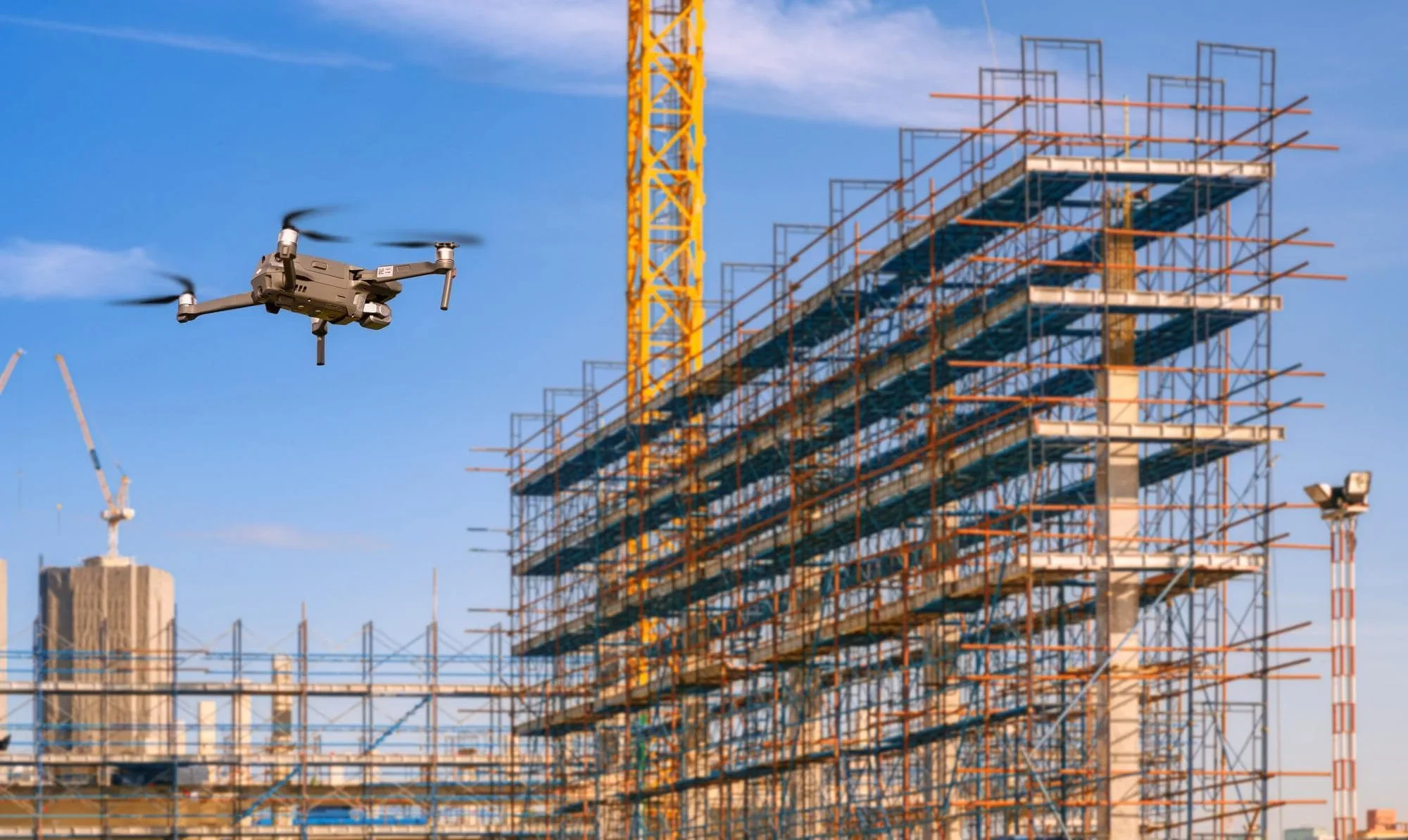
Construction reality capture provides VDC teams with recreation of a space in a digital format, either 2D or 3D, to accurately reflect as-built conditions in BIM (Building Information Modeling) systems and digital twins.
High-quality 3D deliverables—including mesh models, point clouds, TIN surfaces, Gaussian splats, and DSM/DEM datasets—along with survey-aligned 2D orthomosiacs are produced using survey-grade data capture methods (< 3 cm with RTK, GCPs, etc.) and enterprise photogrammetry software. The result is highly detailed, geometrically accurate, and fully georeferenced outputs that support BIM/digital twin system integration, construction progress tracking and reporting, CAD and GIS enhancement, and as-built documentation.
-
Traditional methods of documenting as-built conditions are often manual and labor-intensive. Reality capture allows for quicker, more efficient, and frequent site documentation, which provides accurate information and can play a part in reducing project delays and can save staff hours as issues can be identified and addressed before it’s too late.
-
By integrating reality capture data into a cloud-based platform, teams can work off a single source of truth for accessing up-to-date information from any device, fostering better communication and collaboration among stakeholders.
-
Accurately comparing as-built conditions to project plans helps identify where timelines or workflows may deviate. AI-powered analysis tools further validate completed work, reducing reliance on secondhand (and potentially inaccurate) updates.
-
Highly accurate measurements (down to millimeters) mitigate issues during construction. For instance, for slab pours, detailed reality capture data can detect variances that may require immediate adjustments, preventing costly rework or help teams to adjust the schedule to address non-urgent corrective measures post pour.
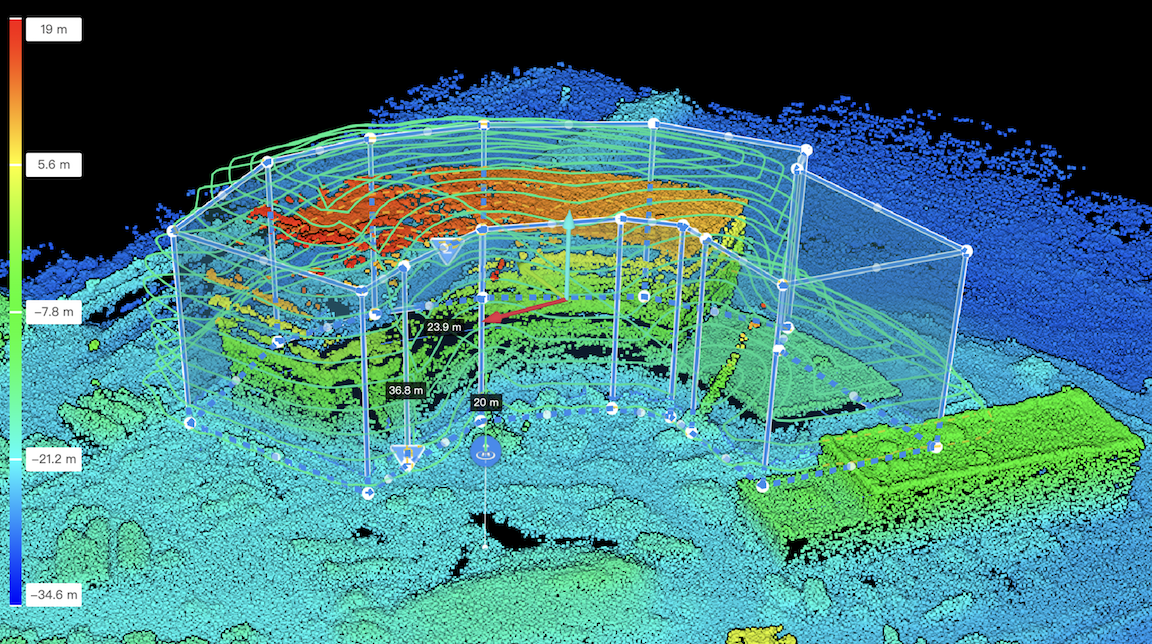
A rough point cloud is captured with the DJI Manifold 3 mounted on the DJI Matrice 4E to generate a Smart3D flight plan at 1-3mm/pixel GSD resolution.
DJI Terra uses sophisticated photogrammetry to stitch thousands of images captured during the flight to render a geo-referenced point cloud (LAS) for BIM, CAD GIS, etc integration.
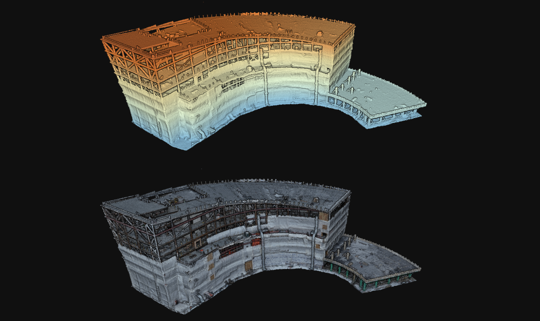
DJI Terra and DJI Modify combine to render a highly detailed and interactive 3D mesh & 2D/3D orthomosiac maps that are used for BIM integration, highly interactive collaboration, inspection, progress monitoring, integration into CAD & GIS systems and so much more.